 Taranaki
A Regional Planning Guide for New Zealand Schools
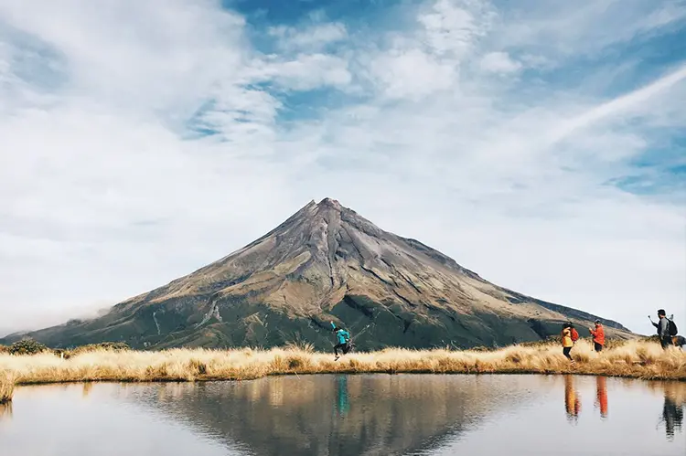
Taranaki is dominated by its namesake mountain (the near-perfectly conical Taranaki Maunga, within what DOC now names Te Papa-Kura-o-Taranaki (formerly Egmont National Park)) with a long, exposed surf coastline giving the region a genuinely distinct land-and-water character.
What Taranaki Suits
Tramping and bush walks are the standout land activity, with Te Papa-Kura-o-Taranaki offering a wide range of tracks from accessible day walks to more demanding routes on the mountain itself: see our Tramping and Bush Walks guide. Taranaki Maunga’s summit route is a genuine alpine undertaking rather than a straightforward walk, and better suited to a guided, well-prepared senior group (see our Multi-Day Tramping and Expedition Skills guide) than a standard school day trip.
Water activities work differently here than in a sheltered-harbour region: Taranaki’s coast (including the well-known Surf Highway 45) is genuinely surf-exposed rather than calm water, so it suits programmes built around surf-specific providers and instruction rather than flatwater paddling. Confirm any provider’s specific surf-safety qualifications and local knowledge of the break being used.
Seasonality and Weather
Taranaki’s weather is heavily shaped by the mountain itself: conditions around Mount Taranaki are known for changing quickly and can differ sharply from the coast on the same day, so a fine morning at sea level is no guarantee of safe conditions higher on the mountain. Summer through autumn (December–April) is the most settled window for tramping; treat any route above the bushline as needing current, mountain-specific forecasts rather than a general regional one, and check with the NZ Mountain Safety Council for current advice.
Getting There
New Plymouth is the natural base for the region, with Egmont National Park’s main access points around 30–45 minutes’ drive and the surf coast readily accessible in most directions from the city.
Local Considerations
Taranaki Maunga’s isolated, symmetrical shape means it generates its own weather rapidly and somewhat unpredictably: treat forecasts for the mountain itself as distinct from the coastal forecast, and build in a lower threshold for turning back than you might on a range with more gradual terrain. See Land and Bush Safety Foundations for the general route-planning principles this applies to.
Worth knowing for context with students: since early 2025, Taranaki Maunga has held legal personhood in its own right, recognising its significance to local iwi: a good talking point for any group visiting.
Find a Provider in Taranaki
Browse camps, venues and activity providers currently listed for the region: All Places in Taranaki.
Leave a Reply
You must be logged in to post a comment.